
 Pointe-à-la-Croix
Sainte-Irène, Quebec
Marsoui
Hecla
Muskrat Dam
Wunnummin Lake
Sainte-Brigitte-de-Laval
Drayton
Mauricie
Pointe-à-la-Croix
Sainte-Irène, Quebec
Marsoui
Hecla
Muskrat Dam
Wunnummin Lake
Sainte-Brigitte-de-Laval
Drayton
Mauricie
Yellowknife Ski Club Chalet on the map, Yellowknife, Canada
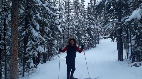
Photo
Where is located Yellowknife Ski Club Chalet
Yellowknife Ski Club Chalet — local attraction, which is located at 4, Yellowknife, NT, Canada and belongs to the category — ski resort. Average visitor rating for this place — 4.3 (according to 25 ratings, information from open sources and relevant for 2022).
Exact location — Yellowknife Ski Club Chalet, marked on the map with a red marker.
You can get directions to Yellowknife Ski Club Chalet on the map from your location.
What else is interesting in Yellowknife? You can see all the sights if you go to the city page.
Coordinates
Yellowknife Ski Club Chalet, Canada coordinates in decimal format: latitude — 62.47194241218503, longitude — -114.37274450127376. When converted to degrees, minutes, seconds Yellowknife Ski Club Chalet has the following coordinates: 62°28′18.99 north latitude and -114°22′21.88 east longitude.
Nearby cities
The largest cities that are located nearby:
- Edmonton — 987 km
- Saskatoon — 1255 km
- Calgary — 1261 km
- Kelowna — 1436 km
- Regina — 1494 km
- Anmore — 1576 km
- Coquitlam — 1578 km
- Burnaby — 1584 km
- Vancouver — 1587 km
- Abbotsford — 1590 km
- Surrey — 1590 km
- Richmond — 1600 km
- Delta — 1604 km
- Spokane
 (United States) — 1651 km
 - Victoria — 1685 km
- Bellevue (United States) — 1742 km
- Seattle (United States) — 1746 km
- Tacoma (United States) — 1786 km
- Winnipeg — 1853 km
Distance to the capital
Distance to the capital (Ottawa) is about — 3088 km.