
 Pointe-à-la-Croix
Sainte-Irène, Quebec
Marsoui
Hecla
Muskrat Dam
Wunnummin Lake
Sainte-Brigitte-de-Laval
Drayton
Mauricie
Pointe-à-la-Croix
Sainte-Irène, Quebec
Marsoui
Hecla
Muskrat Dam
Wunnummin Lake
Sainte-Brigitte-de-Laval
Drayton
Mauricie
Middle Island Irish Historical Park on the map, Miramichi, Canada
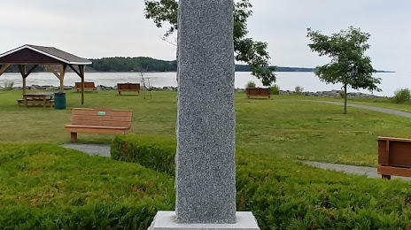
Photo
Where is located Middle Island Irish Historical Park
Middle Island Irish Historical Park — local attraction, which is located at 2345 Water St, Miramichi, NB E1N 3A8, Canada and belongs to the category — museum. Average visitor rating for this place — 4.6 (according to 112 ratings, information from open sources and relevant for 2022).
Exact location — Middle Island Irish Historical Park, marked on the map with a red marker.
You can get directions to Middle Island Irish Historical Park on the map from your location.
What else is interesting in Miramichi? You can see all the sights if you go to the city page.
Coordinates
Middle Island Irish Historical Park, Canada coordinates in decimal format: latitude — 47.05215476214684, longitude — -65.45303400186367. When converted to degrees, minutes, seconds Middle Island Irish Historical Park has the following coordinates: 47°3′7.76 north latitude and -65°27′10.92 east longitude.
Nearby cities
The largest cities that are located nearby:
- Dartmouth — 303 km
- Halifax — 304 km
- Quebec — 435 km
- Levis — 436 km
- Saguenay — 436 km
- Sherbrooke — 527 km
- Trois-Rivières — 542 km
- Longueuil — 642 km
- Montreal — 647 km
- Laval — 654 km
- Manchester
 (United States) — 656 km
 - Lowell (United States) — 678 km
- Boston (United States) — 687 km
- Cambridge (United States) — 689 km
- Worcester (United States) — 737 km
- Providence (United States) — 754 km
- Amherst (United States) — 771 km
- Springfield (United States) — 797 km
- Gatineau — 809 km
Distance to the capital
Distance to the capital (Ottawa) is about — 808 km.