
 Pointe-à-la-Croix
Sainte-Irène, Quebec
Marsoui
Hecla
Muskrat Dam
Wunnummin Lake
Sainte-Brigitte-de-Laval
Drayton
Mauricie
Pointe-à-la-Croix
Sainte-Irène, Quebec
Marsoui
Hecla
Muskrat Dam
Wunnummin Lake
Sainte-Brigitte-de-Laval
Drayton
Mauricie
White Waterfront Conservation Area on the map, Timmins, Canada
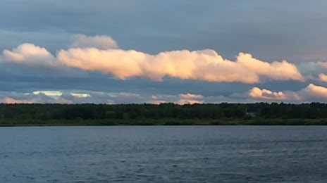
Photo
Where is located White Waterfront Conservation Area
White Waterfront Conservation Area — local attraction, which is located at 58 Lakeview Dr, South Porcupine, ON P0N 1H0, Canada and belongs to the category — park. Average visitor rating for this place — 4.3 (according to 27 ratings, information from open sources and relevant for 2022).
Exact location — White Waterfront Conservation Area, marked on the map with a red marker.
You can get directions to White Waterfront Conservation Area on the map from your location.
What else is interesting in Timmins? You can see all the sights if you go to the city page.
Coordinates
White Waterfront Conservation Area, Canada coordinates in decimal format: latitude — 48.479593211603046, longitude — -81.20396260181408. When converted to degrees, minutes, seconds White Waterfront Conservation Area has the following coordinates: 48°28′46.54 north latitude and -81°12′14.27 east longitude.
Nearby cities
The largest cities that are located nearby:
- Barrie — 470 km
- Richmond Hill — 530 km
- Vaughan — 533 km
- Markham — 535 km
- Brampton — 539 km
- Whitby — 541 km
- Oshawa — 543 km
- Gatineau — 548 km
- Guelph — 552 km
- Toronto — 555 km
- Mississauga — 557 km
- Waterloo — 558 km
- Kitchener — 564 km
- Oakville — 569 km
- Cambridge — 571 km
- Burlington — 583 km
- Hamilton — 590 km
- Kingston — 606 km
- London — 607 km
Distance to the capital
Distance to the capital (Ottawa) is about — 539 km.