
 Pointe-à-la-Croix
Sainte-Irène, Quebec
Marsoui
Hecla
Muskrat Dam
Wunnummin Lake
Sainte-Brigitte-de-Laval
Drayton
Mauricie
Pointe-à-la-Croix
Sainte-Irène, Quebec
Marsoui
Hecla
Muskrat Dam
Wunnummin Lake
Sainte-Brigitte-de-Laval
Drayton
Mauricie
Canatara Beach & Park on the map, Sarnia, Canada
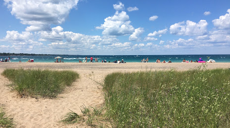
Photo
Where is located Canatara Beach & Park
Canatara Beach & Park — local attraction, which is located at King, George St, Sarnia, ON 600-8567, Canada and belongs to the category — park. Average visitor rating for this place — 4.6 (according to 2082 ratings, information from open sources and relevant for 2022).
Exact location — Canatara Beach & Park, marked on the map with a red marker.
You can get directions to Canatara Beach & Park on the map from your location.
What else is interesting in Sarnia? You can see all the sights if you go to the city page.
Coordinates
Canatara Beach & Park, Canada coordinates in decimal format: latitude — 43.00479835950921, longitude — -82.40284870199822. When converted to degrees, minutes, seconds Canatara Beach & Park has the following coordinates: 43°0′17.27 north latitude and -82°24′10.26 east longitude.
Nearby cities
The largest cities that are located nearby:
- Sterling Heights
 (United States) — 67 km
 - Warren (United States) — 71 km
- Detroit (United States) — 88 km
- Windsor — 89 km
- London — 94 km
- Flint (United States) — 104 km
- Ann Arbor (United States) — 134 km
- Waterloo — 161 km
- Kitchener — 162 km
- Toledo (United States) — 173 km
- Cleveland (United States) — 173 km
- Cambridge — 174 km
- Lansing (United States) — 177 km
- Guelph — 184 km
- Aurora (United States) — 203 km
- Hamilton — 207 km
- Burlington — 213 km
- Akron (United States) — 222 km
- Oakville — 225 km
Distance to the capital
Distance to the capital (Ottawa) is about — 598 km.